NPSO 2014 Annual Meeting
Field Trips
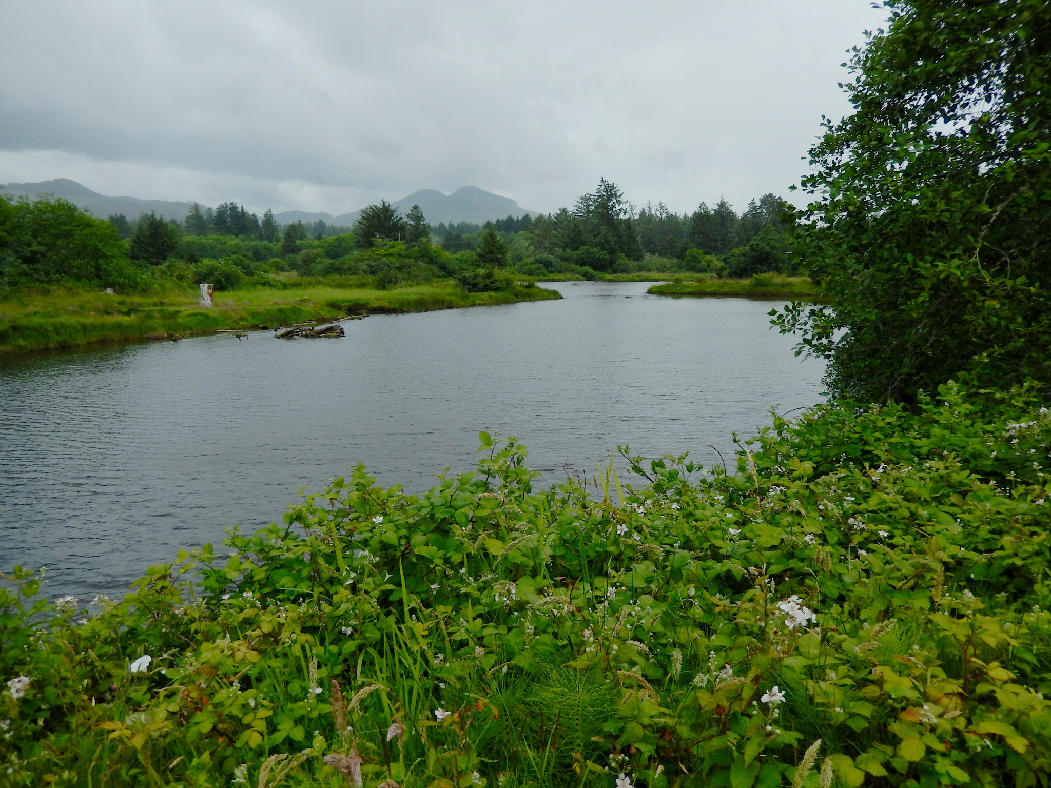
Mill Pond with Saddle Mountain in background (K.Sturgeon)
All field trips depart from the Public Parking Lot on the corner of Hemlock and Gower Streets. Carpooling is encouraged, and expenses should be divided among passengers. Since the weather along the north coast may change from morning to afternoon and differ from low elevation to mountaintop, we recommend dressing in layers and carrying a rain jacket.Average early June high temperature is 61 degrees, and rain and fog are to be expected.
For questions, contact:npsoannmtg2014@gmail.com
For further information, visit these websites:
Columbia Coast Plants (Kathleen Sayce)
http://users.reachone.com/columbiacoastplants
North Coast Land Conservancy
http://nclctrust.org
Friday Field Trip, Noon – 3:00 pm
Ecola Creek Forest Reserve. Leader: Barbara Linnett, Friends of the Cannon Beach Trail. See description in #6 below. Meet at 11:30 am in the Public Parking Lot on the corner of Hemlock and Gower Streets.
Saturday Field Trips, 8:30
am – 4:00 pm (or half-day as noted)
Meet at 8:00 am in the Public Parking Lot on the corner of Hemlock and Gower Streets.
1. High Peak/Moon Creek RNA. Trip Cancelled.
2. Neahkahnie Mountain in Oswald West State Park.
Leader: Celeste Lebo, ecologist. Moderately strenuous (5
miles RT). The trail starts in old growth coniferous forest (Pseudotsuga menziesii, Picea sitchensis, Tsuga heterophylla, and Thuja plicata) up to a summit rock garden with views of
Manzanita, Cape Lookout and the ocean. Diverse wildflowers: Erythronium revolutum, Sidalcea hirtipes, Kopsiopsis hookeri, Castilleja hispida (several color forms), Synthyris reniformis, Silene douglasii, Viola adunca. Elevation at
trailhead 800', summit at 1600'. Drive: 28 miles RT.
Oswald West State Park brochure, trail maps PDF
Oswald
West State Park Trails Map (Warrenton Trails Association)
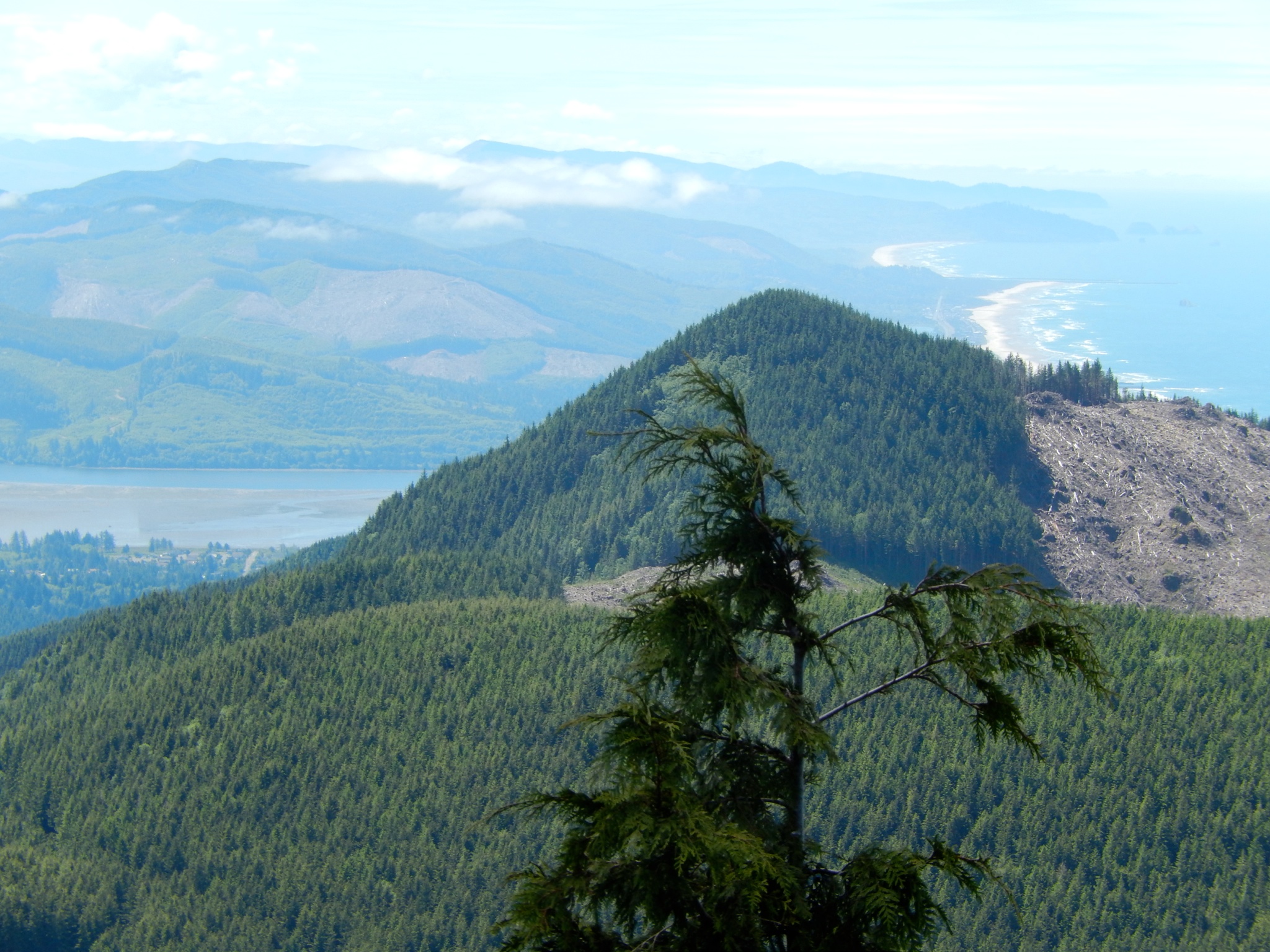
Neahkahnie Mountain from Angora Peak (K.Sturgeon)
3. Neahkahnie Seacliffs,
Oswald West State Park (1/2 day AM). Leader:
Kathleen Sayce, ecologist. Easy (2 mi RT, some uneven ground). Hike along parts of the
Oregon Coast Trail to spectacular basalt cliffs overlooking the ocean, meadows,
seeps. Diverse wildflowers: Castilleja affinis ssp. littoralis, Viola adunca, ssp. adunca, Triteleia hyacinthina, Sidalcea hirtipes, Erigeron
glaucus, Koeleria macrantha, Lomatium martindalei, Sisyrinchium idahoense var. idahoense. Elevation 450' at parking area,
dropping to 200' on seacliffs. Drive: 23 miles
RT.
Oswald West State Park brochure, trail maps PDF
Oswald
West State Park Trails Map PDF (Warrenton Trails Association)
4. Gearhart
Fen Nature Conservancy Preserve. (1/2 day PM; meet at 12:30 for 1 P.M. departure). Leader: Debbie Pickering,
TNC ecologist. Strenuous (2 miles RT, will get wet; rubber
boots recommended). A highly developed fen behind the oldest
dune ridge in Gearhart with floating mats, sphagnum and numerous acid-tolerant
wetland species, Menyanthes trifoliata, Rhododendron columbianum,
Kalmia microphylla,
carnivorous Drosera rotundifolia,
Potentilla palustris,
stunted Pinus contorta, and
several orchid and sedge species. Drive: 20 miles RT.
5. Cape
Falcon in Oswald West State Park (1/2 day AM).
Leader: Hope Stanton, ecologist. Easy (5 miles RT). Hike through dense, old growth conifer
forest, along creeks and meadows, to basalt and sandstone cliffs overlooking
the ocean. Views of Short Sand
Beach, Tillamook Head and Cape Lookout. Diverse wildflowers include Erythronium revolutum, Satureja douglasii, Kopsiopsis hookeri, Poa unilateralis
(ESA threatened), Artemisia suksdorfii, Moneses uniflora, and Erigeron
glaucus. Elevation
gain 200' parking lot to headlands, 100' along seacliffs. Drive: 20 miles RT.
Oswald West State Park brochures, trail maps PDF
Oswald
West State Park Trails Map PDF (Warrenton Trails Association)
6. Ecola Creek Forest Reserve (1/2 day PM; meet at 12:30 for 1 P.M. departure). Trip Cancelled
7. Angora
Peak. Leader: Melissa Reich, NCLC ecologist. Moderate (5 mi RT). Access is
through private timberland with active logging sites; this site is normally
inaccessible to the public. The trail,
on private land, follows an historic railroad grade. Rocky cliffs, meadows and scree slopes
with undisturbed habitat for rare plants of Coast Range balds,
including Castilleja chambersii, C. hispida
(orange & yellow forms), Cladothamnus pyroliflorus, Asarum caudatum, Phlox diffusa and Penstemon cardwellii (purple,
light purple, pink, & white forms). Views of Neahkahnie Mtn and the ocean.
Elev. 1200-2300'. Drive: 26 miles RT (10 miles RT on a
steep gravel road; 4W or AW drive required).
8. Lower
Onion Peak. Leader: Doug Ray, wetlands ecologist, NCLC. Easy (mix of driving and
short walks). Surrounded by private timberland, this site is
normally inaccessible to the public.
The peak supports forested and riparian areas and seeps and is the only
site to see Fillipendula occidentalis,
also Packera flettii, Castilleja chambersii, Saxifraga rupicola, Cascadia nuttallii. Elevation to 2000'. Drive: 40 miles RT (14 miles RT on dirt
roads; high clearance required).
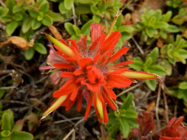
Castilleja hispida (K.Sturgeon)
9. Tillamook
Head - Ecola State Park. Leader: Amy Hutmacher, NCLC ecologist. Moderately
strenuous (5 miles RT). Depart from Indian Beach, and
walk over headland that Lewis & Clark hiked, winter 1806. Coastal forest with old growth Picea sitchensis, Tsuga heterophylla, epiphytes, shrubby and meadow headlands
over seacliffs. Diverse
ferns, sedges, rushes, wildflowers, including Castilleja affinis ssp. littoralis, Synthyris
reniformis, Erythronium revolutum, Erigeron
glaucus. Elevation from sea level at Indian Beach to
1000'. Drive: 4 miles RT.
Ecola State Park brochure PDF
Ecola State Park Trail Map PDF
(Warrenton
Trails Association)
Guide to
the Lewis & Clark National & State Historical Parks (33
pages)
10. Saddle
Mountain State Natural Area. Leader: Laurie Choate, Clatsop Community College. Strenuous (5 miles RT, trail
steep, difficult in spots). Tallest
mountain in the Oregon Coast Range, with diverse habitats: coniferous forests
with Abies amabilis, A. grandis, A. procera and Taxus brevifolia,
riparian zones; seeps, meadows; talus slopes; summit rock garden. High species
diversity, endemics (e.g., Micranthes hitchcockiana), species at northern (e.g., Cardamine californica),
southern (e.g., Geum triflorum
var. ciliatum) and western (e.g., Anenome multifida) range limits. Elev. gain 1600'
to summit at 3288'. Drive: 40 miles RT.
Saddle Mountain State Park brochure, trail map PDF
Saddle
Mountain State Park Trail Map PDF (Warrenton Trails Association)
11. Photographic
exploration of Saddle Mountain State Natural Area. Leader: Craig Markham,
photographer, retired wetland ecologist. See field trip #10. Steep
ascent with photo stops in several different plant communities, ranging through
deep forest, basaltic seeps, meadows, exposed outcrops and balds.
Assistance with photographic techniques. Bring camera with macro- and wide-angle capabilities.
Tripod, remote shutter release and rain protection recommended. Limit 15
participants. (View photos by Craig at http://cpmarkham.zenfolio.com)
Saddle Mountain State Park brochure, trail map PDF
Saddle
Mountain State Park Trail Map PDF (Warrenton Trails Association)
12. North
Coast Land Conservancy Habitat Preserves: Circle Creek Swamp, Mill Pond, Neacoxie Creek, Silverspot
Meadow, and Necanicum Estuary. Katie Voelke, NCLC ecologist. Easy (short
walks; optional wading, rubber boots recommended). NCLC
conserves connectivity of coastal ecosystems. This excursion explores the Necanicum watershed, including restoration of a former
dairy farm and naturalized mill pond in the upland stream corridor, dune
ecology of a remnant coastal prairie, and the confluence of estuarine marsh and
forest. Plant communities and
species include undisturbed spruce wetland forest alongside newly established
forest with Picea
sitchensis, Thuja plicata, Acer
spp., Alnus rubra and
shrubs such as Lonicera involucrata and Ribes spp.;
coastal prairie with Armeria maritima, Tanacetum bipinnatum, Symphyotrichium subspicatum, Triteleia hyacinthina, Viola adunca
ssp. adunca,
Carex pansa, and Festuca rubra; and
estuarine marsh with Cuscuta pacifica, Carex lyngbyei, Deschampsia cespitosa.
Drive 40 mi RT.
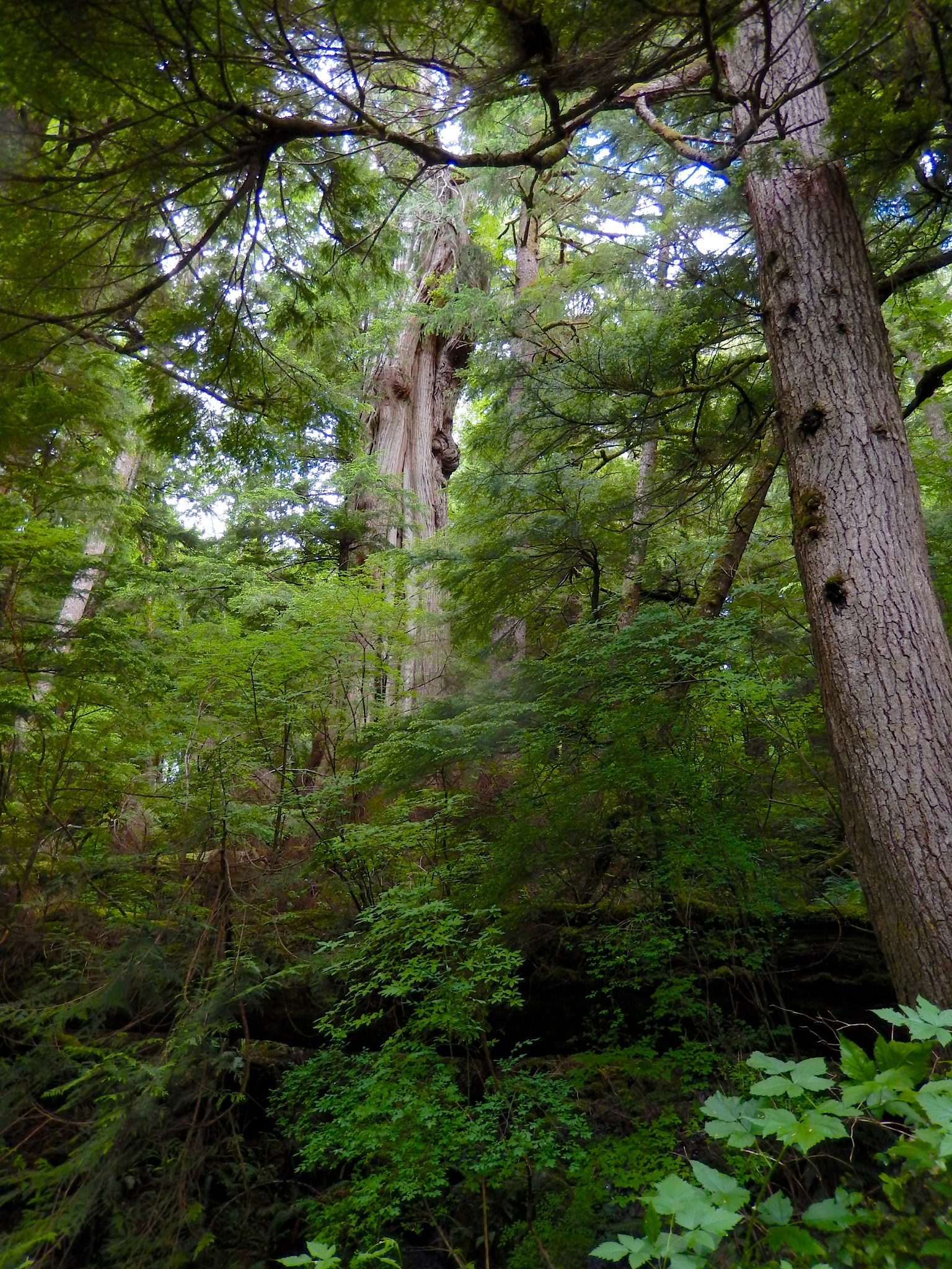
Old Growth Sitka Spruce in Ecola Creek Forest Reserve (K. Sturgeon)
13. Gnat Creek (1/2 day AM). Trip Cancelled.
14. Lewis
and Clark National Historical Park: South Slough and Kwis
Kwis Trails. Leader: Carla Cole, NPS. Easy-moderate
(2.5 miles RT, option for longer hike). Ongoing restoration of 44 acres of estuarine
wetland habitat for five species of salmon through creation of one mile of new
tidal channels. South Slough loop trail starts at Fort Clatsop,
travels through timber plantations being actively restored to Picea sitchensis
rainforests (view effects of Great Coastal Gale of 2007) and encircles a marsh
restoration site now supporting Sagittaria latifolia, Typha latifolia, Carex lyngbeii and other emergent marsh species. Kwis Kwis trail (optional:
additional 2.5 miles) winds through older Sitka spruce forest in the park.
Drive: 48 miles RT.
Fort
Clatsop, Lewis & Clark National Historical Park Trail Map PDF (Warrenton
Trails Association)
Guide to
the Lewis & Clark National & State Historical Parks (33
pages)
15. Fort Columbia State Park (Washington): Scarborough Hill, Canyon Creek Loop and Station Camp. Trip Cancelled.
Sunday Field Trip, 9 am - Noon
Cape Falcon in Oswald West State Park. Leader: to be determined. See description in #5 above. Meet at 8:30 a.m. in the Public Parking Lot on the corner of Hemlock and Gower Streets.
If you have questions that aren't answered here, send email to npsoannmtg2014@gmail.com.